


BELLEVILLE 26 Voting District, St. Clair County, Illinois
About
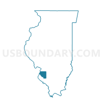
Outline

Summary
| Unique Area Identifier | 574363 |
| Name | BELLEVILLE 26 Voting District |
| County | St. Clair County |
| State | Illinois |
| Area (square miles) | 4.06 |
| Land Area (square miles) | 4.04 |
| Water Area (square miles) | 0.02 |
| % of Land Area | 99.59 |
| % of Water Area | 0.41 |
| Latitude of the Internal Point | 38.49304000 |
| Longtitude of the Internal Point | -89.93187970 |
Maps


Graphs
Select a template below for downloading or customizing gragh for BELLEVILLE 26 Voting District, St. Clair County, Illinois


Neighbors
Neighoring Voting District (by Name) Neighboring Voting District on the Map
- BELLEVILLE 24 Voting District, St. Clair County, IL
- BELLEVILLE 25 Voting District, St. Clair County, IL
- BELLEVILLE 33 Voting District, St. Clair County, IL
- FREEBURG 4 Voting District, St. Clair County, IL
- SHILOH VALLEY 2 Voting District, St. Clair County, IL
- SHILOH VALLEY 4 Voting District, St. Clair County, IL
- SMITHTON 4 Voting District, St. Clair County, IL
- ST CLAIR 14 Voting District, St. Clair County, IL
- ST CLAIR 18 Voting District, St. Clair County, IL
Top 10 Neighboring County Subdivision (by Population) Neighboring County Subdivision on the Map
- Belleville township, St. Clair County, IL (44,478)
- St. Clair township, St. Clair County, IL (35,498)
- Shiloh Valley township, St. Clair County, IL (11,631)
- Freeburg township, St. Clair County, IL (5,109)
- Smithton township, St. Clair County, IL (4,275)
Top 10 Neighboring Place (by Population) Neighboring Place on the Map
Top 10 Neighboring Elementary School District (by Population) Neighboring Elementary School District on the Map
- Belleville School District 118, IL (38,866)
- Belle Valley School District 119, IL (8,407)
- Freeburg Community Consolidated School District 70, IL (7,328)
Top 10 Neighboring Secondary School District (by Population) Neighboring Secondary School District on the Map
- Belleville Township High School District 201, IL (109,653)
- Freeburg Community High School District 77, IL (12,887)
Top 10 Neighboring Unified School District (by Population) Neighboring Unified School District on the Map
Top 10 Neighboring State Legislative District Lower Chamber (by Population) Neighboring State Legislative District Lower Chamber on the Map
- State House District 116, IL (110,789)
- State House District 114, IL (104,780)
- State House District 113, IL (104,465)
Top 10 Neighboring State Legislative District Upper Chamber (by Population) Neighboring State Legislative District Upper Chamber on the Map
Top 10 Neighboring 111th Congressional District (by Population) Neighboring 111th Congressional District on the Map
Top 10 Neighboring Census Tract (by Population) Neighboring Census Tract on the Map
- Census Tract 5039.04, St. Clair County, IL (10,394)
- Census Tract 5033.04, St. Clair County, IL (6,952)
- Census Tract 5033.34, St. Clair County, IL (6,570)
- Census Tract 5039.06, St. Clair County, IL (5,471)
- Census Tract 5033.32, St. Clair County, IL (5,265)
- Census Tract 5019, St. Clair County, IL (3,620)
- Census Tract 5039.03, St. Clair County, IL (3,385)